Sunday, February 25, 2018

Janurary 21, 2018 - Finished Sherman Gap Trail

Picture of the day

    This blog chronicles the hikes I've completed in the "Lee 333 Challenge". I haven't set a challenge deadline because I can't dedicate myself 100% to it. However, if the SNAP500 (or SHEN500) can be done in one year, I don't see any reason why a dedicated enthusiast couldn't complete the "Lee 333" in under a year also.

Today's Hike:     
     Distance: 5.14 mi
     Duration: 4:17
     Ascent: 1794ft
     PATC Difficulty: 136

Lee 333 Progress Summary:
     Trails: 11 of 115
     Trail Miles:  34.36 of 342.45 miles
     Hiked Miles:  55.42 mi

Today's Track

    Today's trip took me from the Sherman Gap trailhead on Panhandle road up to the Massasnutten Trail on the ridge and then following the Massasnutten trail north to where the Sherman Gap trail heads down the western slope, from there I returned to the car the way I'd come.
 
Trying to stitch together 2 panoramic shots, didn't really work that well.
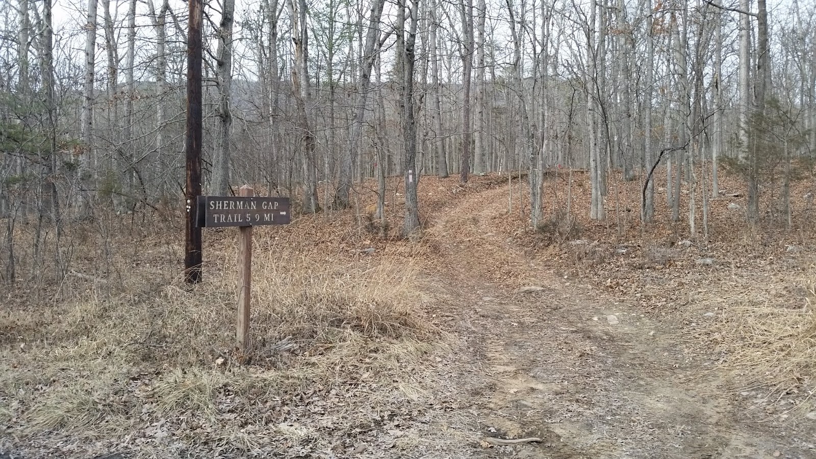
Trailhead on Panhandle Road

     There was no parking area, I just pulled off the road as far as I could.

Trail starts out flat and easy to navigate

Here you can see the ridge and Sherman Gap

Looking back east you can make out the south fork of the Shenandoah River

The trail slowly begins to wind up hill

Now, the climbing begins...


Looking back you can appreciate the incline better then looking ahead.

and on it goes... up, up and ...

...up

Ah, now I could see Sherman's Gap ahead.

As the trail approaches the Gap it becomes rocky...

and still more rocky

A view back towards the Shenandoah valley.

...more climbing...


Getting some altitude now...

The final few yards before the ridge (gap).

Intersection with the Massasnutten Trail

     Once I reached the ridge and the Massasnutten trail, I turned north and continued to the point where the Sherman Gap trail heads down the western slope of the ridge. 

The first Sherman Gap trail intersection with the Massasnutten Trail

The car is back down there somewhere.

The second intersection of the Massasnutten trail and the Sherman Gap trail

     Here is my destination for the day, the point where Massasnutten trail and the Sherman Gap trail parts ways and Sherman Gap Trail heads down the western slope of the ridge. I spent about 30 minutes here having lunch and resting before heading back to the car.

View from my lunch spot.

Friday, January 12, 2018

December 30, 2017 - Shawl Gap Trail and Shawl Gap Spur

The "Lee 333 Challenge"

Picture of the day

    This blog chronicles the hikes I've completed in the "Lee 333 Challenge". I haven't set a challenge deadline because I can't dedicate myself 100% to it. However, if the SNAP500 (or SHEN500) can be done in one year, I don't see any reason why a dedicated enthusiast couldn't complete the "Lee 333" in under a year also.

Today's Hike:     
     Distance: 5.63 mi
     Duration: 3:24
     Ascent: 1457ft
     PATC Difficulty: 128

Lee 333 Progress Summary:
     Trails: 10 of 115
     Trail Miles:  31.95 of 342.5 miles
     Hiked Miles:  50.28 mi

Today's Track
     Today's hike started late, it was very cold and I took a nap in the car at the trail head before I ever got started.

Start of the trail on Panhandle Road

View of the ridge from the valley near the start of the trail, that's the destination.
The trail begins as a forest road
It's nice and easy going... at first.
The trail is open sky and sunny just before the 'road' section ends, glad it's not summer or I'd hate the heat here.
Trail starts to climb in earnest now that the road section is behind me.
The trail has a few rocky sections, but not many and not for long
Nice easy going....again

Looking back down hill, a spur trail leads back down the mountain towards private property.

    To the left in the picture, I came up the trail to the right. I'll explore the spur to the forest property line on the way back.

The trail gets steep as it approaches the ridge
Almost there...the ridge is in sight
This is the ridge, the Shawl Gap trail meet the Massanutten trail.
It was cold and windy, so I didn't stay long.

On the ridge (looking west)

On the ridge (looking east)

In this picture is what I think is a horse's snow shoe, it must have fallen off. 

    On my way back down I took the spur trail about a mile to the forest boundary line. The trail continues onto private property, but I turned back since it was getting late. Apparently there are a lot of trail that are like this spur in the National Forest, I'm going to add them to the Lee333 challenge as I discover them.

Nice burl on the spur trail

I didn't stop to rest the entire hike since is was too cold to be comfortable. I later paid the price with sore feet and aching calves.

A view into the valley looking east as the day lost it's light and the cold began to set in.


Thursday, December 14, 2017

December 9, 2017 - Mudhole Gap Completed

The "Lee 333 Challenge"

Just leaving the car at Little Fort Valley on the ridge

    This blog chronicles the hikes I've completed in the "Lee 333 Challenge". I haven't set a challenge deadline because I can't dedicate myself 100% to it. However, if the SNAP500 (or SHEN500) can be done in one year, I don't see any reason why a dedicated enthusiast couldn't complete the "Lee 333" in under a year also.

Today's Hike:     
     Distance: 6.13 mi
     Duration: 3:30
     Ascent: 1172ft
     PATC Difficulty: 120

Lee 333 Progress Summary:
     Trails: 8 of 114
     Trail Miles:  28.75 of 339.22 miles
     Hiked Miles:  44.65 mi

     A beautiful day with light snow all day.

Mudhole Gap Track for Little Fort Valley to Sidewinder Trail

     The day dawned with snow in the forecast but I was not going to let that stop me from getting out on the trail. I drove out to Front Royal and into Fort Valley intending to hike the Mudhole Gap trail. However, when I turned on to Boyer Road I saw a sign that said that road ahead was closed. I assumed it meant F66 and that it was because of the snow. I pulled over and spent a few minutes looking through the trail guide for an alternative. A local resident stopped to see if I needed help, nice! I settled on Mine Gap trail because I could walk to the trailhead if the road was gated near Mine Mtn Road. But when I got to the intersection of F66 and Mine Mtn Road the road was open so I was able to drive to Little Fort Valley. 

Looking back at the parking area at Little Fort Valley, and the 1st of 4 stream crossings.
(My car is just behind the trees)

    It was lightly snowing but the road (F66) was not icy in spite of the gently falling snow. I parked at the Mudhole Gap trailhead in Little Fort Valley. The hike was pleasant under gray skies and light snow. The trail headed gently down a nice stream valley until it made a sharp left turn (north) and soon became a forest road. At the left turn there is an unmarked trail that continues straight, I decided to explore that trail on another day or on my way back to the car.

Another one of the stream crossings


Mud holes on the first half mile of the trail, not a surprise!

Nearing another of the stream crossings


Looking back to the point where the 'trail' and the 'road' meet.

     I was kept entertained during the hike by the falling snow, the stream and an audio book playing on my phone. Time passes quickly with a book and while going downhill. I haven't been hiking much in the last year so I wasn't sure If I'd make it all the way to the Sidewinder trail (3 miles, a point where I'd already hiked). I really wanted to make it since it would mean that I'd complete the entire trail. Six miles would be my longest hike in quite a while.

Junction of Mudhole Gap and Sidewinder Trails

Looking back from the Sidewinder trail junction

   At some point I realized that I was walking on another hiker's footprints in the snow. This hiker must have come up the trail earlier in the day but not all the way up to the ridge. Once I reached the Sidewinder trail intersection, I paused to eat some lunch before hiking back up to the car. After eating, I was getting cold and when I reached for my gloves, discovered that I only had one. Since they are black I thought I'd be able to spot the missing one against the new snow on my return journey. I found it after about a mile.

A view from Boyer road

   Once I got to the end of the road portion and was at the sharp turn in the trail, I turned down hill to see what trail options might be in that direction. I thought it might be only a few hundred yards to the Forest Boundary line but when the trail split into two with in a couple hundred feet I gave it up for that day. I was getting tired and it was getting colder so I made the hike back to the ridge along the creek with the snow highlighting the trees and bending branches into my path. I reached the car at 4pm and headed home.

A view of the Little Crease Mountain from Boyer road