Monday, February 26, 2018

Feburary 25, 2018 - Veach Gap (Eastern Half) and Massanutten Trail to Little Crease Shelter


Picture of the day

    This blog chronicles the hikes I've completed in the "Lee 333 Challenge". I haven't set a challenge deadline because I can't dedicate myself 100% to it. However, if the SNAP500 (or SHEN500) can be done in one year, I don't see any reason why a dedicated enthusiast couldn't complete the "Lee 333" in under a year also.

Today's Hike:     
     Distance: 5.39 mi
     Duration: 4:42
     Ascent: 1695ft
     PATC Difficulty: 135

Lee 333 Progress Summary:
     Trails: 11 of 107
     Trail Miles:  37.24 of 342.45 miles
     Hiked Miles:  60.81 mi


Today's Track


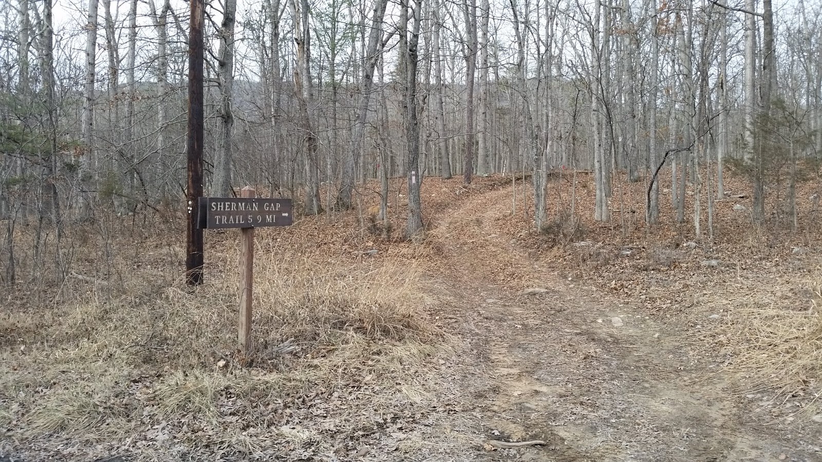
Trail head on Panhandle Road (taken at 6pm at the end of the hike)

The trail starts of easy and flat as do most of the trail I've hiked that start of on the eastern slope

I starting hiking about 2pm, I had waited in the car for about an hour hoping the rain would stop and convincing myself to get out there and start. 
I had a very large umbrella tired to my pack that kept me dry all day.

The trail was not too steep and easy to hike.

But as I continue the grade increased and the fog did too. No views today.


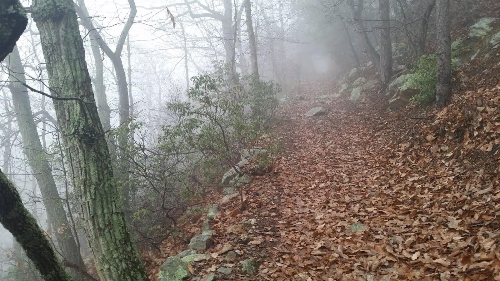
I bet there are some good view to the east on a clear day.

Getting closer to the ridge the terrain became much rockier but not for long

This is the intersection where the Veach Gap trail turn right (north) and joins the Massasnutten trail until reaching Veach Gap and Little Crease Shelter. 

Heading down off the ridge into Veach Gap Little Crease

A quick picture as I passed Little Crease Shelter (only 200 yards to go)

I passed the shelter and reached the Gap where the trail crosses Mill Run, I forgot to take a picture. 
Then headed back to the shelter for lunch.

The shelter was fantastic, dry new and clean, I spent about 40 minutes there. 
Oh.. and a new clean out house too.

Here is a video of the shelter on YouTube: https://youtu.be/j37DrIgIFfQ

Heading back to the ridge and the car. It was tough to leave the shelter and get back out into the rain especially when I had just eaten. It's hard to get going and climb back to the ridge all over again.

Sunday, February 25, 2018

Janurary 21, 2018 - Finished Sherman Gap Trail

Picture of the day

    This blog chronicles the hikes I've completed in the "Lee 333 Challenge". I haven't set a challenge deadline because I can't dedicate myself 100% to it. However, if the SNAP500 (or SHEN500) can be done in one year, I don't see any reason why a dedicated enthusiast couldn't complete the "Lee 333" in under a year also.

Today's Hike:     
     Distance: 5.14 mi
     Duration: 4:17
     Ascent: 1794ft
     PATC Difficulty: 136

Lee 333 Progress Summary:
     Trails: 11 of 115
     Trail Miles:  34.36 of 342.45 miles
     Hiked Miles:  55.42 mi

Today's Track

    Today's trip took me from the Sherman Gap trailhead on Panhandle road up to the Massasnutten Trail on the ridge and then following the Massasnutten trail north to where the Sherman Gap trail heads down the western slope, from there I returned to the car the way I'd come.
 
Trying to stitch together 2 panoramic shots, didn't really work that well.

Trailhead on Panhandle Road

     There was no parking area, I just pulled off the road as far as I could.

Trail starts out flat and easy to navigate

Here you can see the ridge and Sherman Gap

Looking back east you can make out the south fork of the Shenandoah River

The trail slowly begins to wind up hill

Now, the climbing begins...


Looking back you can appreciate the incline better then looking ahead.

and on it goes... up, up and ...

...up

Ah, now I could see Sherman's Gap ahead.

As the trail approaches the Gap it becomes rocky...

and still more rocky

A view back towards the Shenandoah valley.

...more climbing...


Getting some altitude now...

The final few yards before the ridge (gap).

Intersection with the Massasnutten Trail

     Once I reached the ridge and the Massasnutten trail, I turned north and continued to the point where the Sherman Gap trail heads down the western slope of the ridge. 

The first Sherman Gap trail intersection with the Massasnutten Trail

The car is back down there somewhere.

The second intersection of the Massasnutten trail and the Sherman Gap trail

     Here is my destination for the day, the point where Massasnutten trail and the Sherman Gap trail parts ways and Sherman Gap Trail heads down the western slope of the ridge. I spent about 30 minutes here having lunch and resting before heading back to the car.

View from my lunch spot.

April 20, 2024 - Cedar Creek Trail and part of Narrow Passage Road

Picture of the Day           This blog chronicles the hikes I've completed in the "Lee 333 Challenge". I named the challenge...