Tuesday, May 22, 2018

May 12, 2018 - More Massannutten Trail, Forest Road 66 to the Strasburg Reservoir and Little Passage Creek Trail to Signal Knob

Picture of the Day

    This blog chronicles the hikes I've completed in the "Lee 333 Challenge". I haven't set a challenge deadline because I can't dedicate myself 100% to it. However, if the SNAP500 (or SHEN500) can be done in one year, I don't see any reason why a dedicated enthusiast couldn't complete the "Lee 333" in under a year also.

Today's Hike:
Distance: 8.94
Duration: 5:09
Ascent: 1392ft
PATC Difficulty: 157

Lee 333 Progress Summary:
Trails: 16 of 107
Trail Miles: 49.47 of 342.2 miles
Hiked Miles: 87.76 miles

Today's Track

    OMG, this was my worst hike thus far. Most of the route was easy hiking, except the final half mile up to Signal Knob. What made is a killer for me was that it was 92 degrees for most of the hours I was hiking.


The gated FR 66/trail

Parking area on FR 66

Next to the parking are is a nice piped spring.

This small building is next to the piped spring and the parking area.

The first 2 miles from the parking area to the Strasbourg Reservoir is a easy mostly flat hike. 

A couple of backpackers and a group of horseback riders passed me in this section. 

The Massanutten trail leaves FR 66 before the Reservoir but just skirts the lake on the western side while the FR 66 passes on the eastern side.

More flat trail just before the lake

This looks really good but I was really really hot after just 2 miles!

I'm going in, no matter what!

A view of the dam

Wow, no way! Well perhaps just a quick dip.

I walked into the water and put my head under several times but can swear that I never swam once. The lake was not that cold.

Strasburg Reservoir 

Strasburg Reservoir 

The FR 66 is crossed by little passage creek

A really nice intersection with the Massanutten/Little Passage Creek Trail


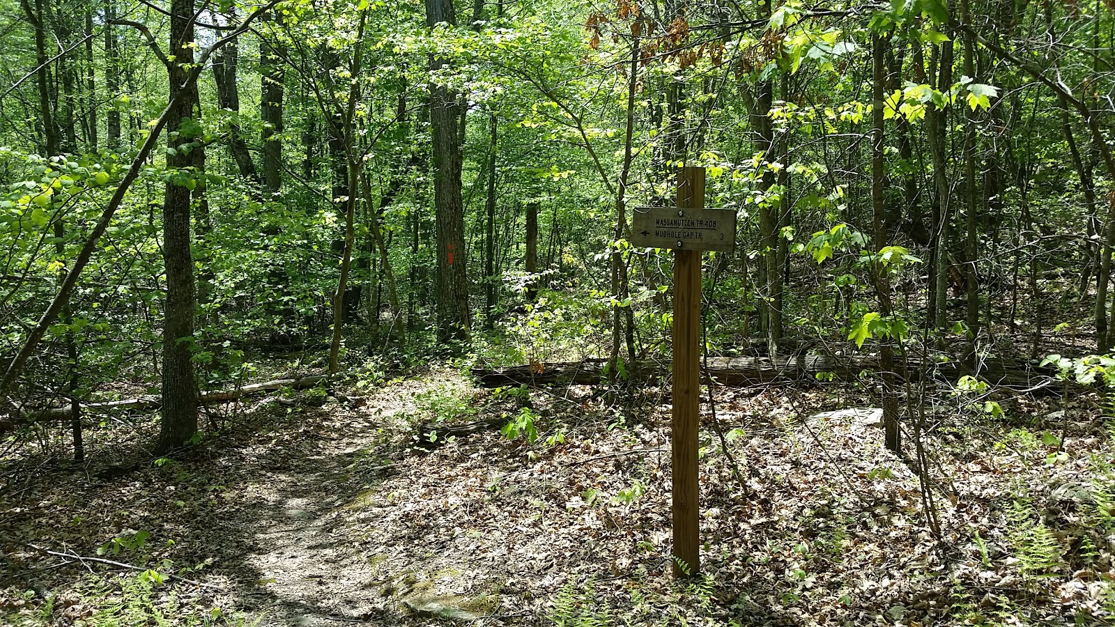
Massanutten/Little Passage Creek Trail Intersection Sign

Another really nice intersection with the Tuscarora Trail

Tuscarora Trail

Tuscarora Trail sign where it crosses FR 66

A couple passed me coming down from the Knob near here.

Now FR 66 begins to climb

    I have no pictures of this hot steep rocky road to the peak. I was hot, exhausted and at one point I actually considered turning back (not seriously) but at one point I had to sit in the feeble shade of a small tree on a boulder within sight of the top wondering if I'd ever get there and why I was doing this anyway?

There was a small breeze at the top but the flies would not let me rest in peace.

A guy passed through wearing long blue jeans! He didn't even seem hot.

A view of Strasburg from Signal Knob

A view of Strasburg from Signal Knob

     On the long hot slog back to the car I made use of the benches at the trail intersections (thank you). It was a long final 2 flat miles back along the FR 66 to the car. I got some minor relief when some clouds moved in and finally blocked the sun a bit. Some boy scouts were setting up camp not too far from the parking area. We said hello but I was too tired to talk.

    On the whole the trip was not enjoyable. I think I'd have been better off waiting a few hours before starting and hiking back in the twilight when it might have been a bit cooler.

Crossing Little Passage creek on the Little Passage Creek Trail
on my return trip rounding the lake on it's western side.


Wednesday, May 9, 2018

April 14, 2018 - More Manassanutten Trail via Veach Gap East Trail

Picture of the day

    This blog chronicles the hikes I've completed in the "Lee 333 Challenge". I haven't set a challenge deadline because I can't dedicate myself 100% to it. However, if the SNAP500 (or SHEN500) can be done in one year, I don't see any reason why a dedicated enthusiast couldn't complete the "Lee 333" in under a year also.

Today's Hike:
Distance: 8.0
Duration: 5:14
Ascent: 2166ft
PATC Difficulty: 186

Lee 333 Progress Summary:
Trails: 13 of 107
Trail Miles: 46.07 of 342.45 miles
Hiked Miles: 78.05 miles

Today's Track

    It was a great day to be on the trail. When I arrived at the parking area on Panhandle road there were about 25 or 30 bikes and one guy in a lawn chair. He was monitoring a triathlon. We spoke for a minute or two and I learned that he planned to hike the AT next year. He was reading "A walk in the Woods" by Bill Bryson.

See "boat was inflatable" below....

From the Shenandoah River State park, here is a view of the Massanutten ridge where I hiked today.


  Hard to believe that I'll be on that ridge in just a couple of hours.


Well a couple of hours have passed...now, I'm on the Massanutten trail looking back down towards the Shenandoah State park where I was in the last two pictures.

This is where I met the three triathletes

    I set out to reach the ridge as soon as possible because I'd hiked the Veach Gap east trail before and wanted to get to some new trail. The last half mile is steep and gave me a good workout, once again. On my way up I passed 5 or 6 of the triathletes coming down. They looked hot and tired but were keeping up a brisk pace. 

     Upon reaching the Massanutten trail on the ridge I met three guys, wearing the yellow vests of the triathletes, sitting on a log. One of them asked me if I had any extra water. My initial reaction was to say that I couldn't spare any, I had 6 more miles to go on a hot day, but after seeing him put his head down and hands on his face I quickly changed my mind. I offered him a bottle of Gatorade. He drank about a third of it and tried to give it back. I said that he should finish it. He gave it to the guy next to him who had been keeping a eye on him. All three were friends running the race together. They shared the rest of it and I took the empty back. The first guy was trying to psyche himself up by reminding himself to "closely mind the trail ahead" since it is a mine field of loose rocks and steeply downhill. All four of us talked for about 5 minutes. I learned that one was a middle school computer teacher, one a general contractor and the third...I forget. They thanked me and were off again down the way I'd come up.


My first break. I'm just left the Veach Gap trail and turned south on the Massanutten trail.

     I did a little experiment with the camera and my sun glasses. Although they are prescription (not bifocals), the camera (cell phone) is still able to focus.  I thought it might cut the sun's glare. It did but it just looks like sepia photo to me.

Here's another with the sun glasses

This one and the next are for comparison (with and with out the sun glasses filter)

Without the filter

    I turned south and hiked along the Massanutten trail until I reach a local high point, I had gotten hot and needed a rest. I sat in the shade of a large tree trunk while the wind blowing up from the valley cooled me. It was a beautiful day and I just relaxed and made a call my wife (good cell signal on the ridge). It was easy to get started again since I knew I didn't have any more climbing to do because the trail stays on the ridge for miles from here south.

   I continued south on the Massanutten trail, keeping an eye out for the Dry Run trail. I found the abandoned Dry Run trail marked with a small rock cairn. The lower end of the trail is now on private land with no public access. I intended to hike down the Dry Run trail but changed my mind after seeing that it was in poor shape. That was supposed to be my turnaround point but since the trial was flat and the weather nice I continued on the Massanutten Trail far enough to round out the day's hike to 8 miles.
    

No Filter

Filtered

Near the Abandoned Dry Run Trail

Now, I'm over heated

Looking up from my bed of leaves

    I'd grown very tired and hot on my hike north, back the way I'd come, but kept going looking for the perfect place to take and extended break. I finally collapsed in a pile of leaves just off the trail. I really hate doing that because of the ticks. Next trip, I'll be sure to pack a ground sheet (Tyvek). Sure enough, as I was getting up to leave 30 minutes later I found a tick walking up my arm.


Heading back down Veach Gap Trail


    It was an uneventful walk back to the car but my day was not over just yet. As I drove south along Panhandle Road (a small dirt road in the middle of nowhere at about 6:30pm) I saw a guy walking along with a mostly empty water bottle and nothing else. I stopped and offered him a ride and he quickly accepted.

   After giving him a Gator-aid, he told me an interesting story of how he ended up there. It seems that he had been on a 3 day river trip on the North Fork of the Shenandoah when he came upon several canoes attempting to recover gear scattered in the river as a result of a capsized canoe. He pitched in to help out. That's when he paused to mentioned that his boat was inflatable. And yes, it did spring a leak when he was swept into a rock while helping. 

    The canoeists took him aboard one of their boats. They ferried him several miles farther then they had intended to go that day and eventually put him ashore where he could make his way out to a road. They stashed his gear at this point too. Since that time, he'd been road walking. I'm not sure how many hours that was but he said he'd walked over 10 miles by the time I picked him up. 

   He told me where his car was parked. It was still over 20 miles away and he'd been hiking the wrong way. Someone had given him bad directions. I really don't know what his plan at that point was but probably just to get anywhere. I, of course, drove him all that way to his car. We had a nice long talk and discovered that he's a Computer Science major at the University of Maryland, my alma mater!


Go Maryland

April 20, 2024 - Cedar Creek Trail and part of Narrow Passage Road

Picture of the Day           This blog chronicles the hikes I've completed in the "Lee 333 Challenge". I named the challenge...