This blog chronicles the hikes I've completed in the "Lee 333 Challenge". I haven't set a challenge deadline because I can't dedicate myself 100% to it. However, if the SNAP500 (or SHEN500) can be done in one year, I don't see any reason why a dedicated enthusiast couldn't complete the "Lee 333" in under a year also.
Today's Hike:
Distance: 6.58
Duration: 4.25
Ascent: 1842ft
PATC Difficulty: 155
Lee 333 Progress Summary:
Trails: 22 of 107
Trail Miles: 59.27 of 344.66 miles (285.39 miles to go)
Hiked Miles: 113.34 miles

Today's Track
Getting started today was a challenge. After my usual late start, FR66 was closed again so I headed south towards the Woodstock fire tower hoping to hike one of the trails from there only to be stopped by a flooded road. Next, I crossed over to the eastern side of Fort Valley, driving through Seven Fountains, in hopes of hiking up Dry Run Trail. Once I found the trail head, I could not find any parking that I felt comfortable with (it was surrounded with private land and posted signs). The locals were driving by "eyeballing" me too. Finally, I settled on the seldom used "Stephens Gap trail" to take me up to the ridge and the Massanutten Trail.
I'm writing this a month after this hike. I know now that my Lyme Disease symptoms had returned for the 3rd time making this hike more difficult that it might otherwise have been. I'm on a new oral antibiotic course that seems to be helping. I hope that I won't have to get back on the IV antibiotics again, after becoming allergic to the best Lyme Disease antibiotic last time.
I'm writing this a month after this hike. I know now that my Lyme Disease symptoms had returned for the 3rd time making this hike more difficult that it might otherwise have been. I'm on a new oral antibiotic course that seems to be helping. I hope that I won't have to get back on the IV antibiotics again, after becoming allergic to the best Lyme Disease antibiotic last time.

Flooded Road (It was was over 18 inches deep)
A truck drove through ahead of me and that's what convinced me to turn back.

Stephens Gap Trail head??
I spotted this rough road that seemed to be the trail, I parked here at what I'm calling "My" trail head and began hiking. As I hiked, I noticed that there are access points on both sides of this road and that these must be privately owned lots. There were no buildings on them and at the time I didn't realize that I might have blocked the only access to these private plots. On a future trip I may drive up this road and park past the last access point so I won't block the road.

Stephens Lane right at "My" trail head.
The house in the trees on the left side of the picture was abandoned during construction and was empty.

Looking up Stephens Gap Trail from "My" trail head

Beginning of the Stephens Gap Trail

Looking back towards the car
After a short distance the trail (rough road) joins a well maintained gravel road. At about the 0.5 mile mark it crosses another very well maintained gravel road and enters the woods again leaving the private land behind. I'm not sure why I didn't take any pictures.

A nice section of the lower part of the trail

Gaining some altitude

Ahh....finally on National Forest Land

A really nice park of the lower trail

The trail crosses a hollow with a couple of streams
The trail get very steep for about 0.3 mile before crossing a hollow with a couple of streams.

One of the two stream crossings

The trail is the stream here

A backlit selfie

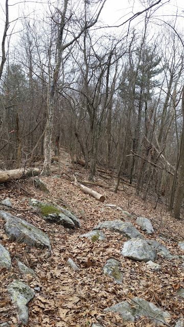
Climbing the upper part of Stephens Gap Trail to the ridge
It's still a rough woods road at this point and continues past the sharp left turn onto an actual trail that takes you up to the ridge. Well, I missed that turn and continued for another few hundred yards before realizing my mistake. Using my GPS, I bushwhacked back over to the trail and headed up to the ridge.

Stephens Gap Trail intersection with the Massanutten Trail


This is where I stopped for lunch this time and on the Indian Grave Ridge Trail hike.

Hiking north on the Massanutten Trail

Following the Massanutten ridge
The wind was really whipping around that day
Once on the ridge the wind was really whipping around and I was happy to be out from under the larger trees on the slopes. The trees on the ridge are stunted and I hoped that would mean that no large branches could be blown down on me.

Looking down to the east to the Shenandoah river

The ridge is very narrow here

Shenandoah National Park is to the east

Cool!

Finished....now it's time for a quick retreat back to the car hopefully before it gets dark
I knew I was under the clock now, the sun sets early in February and I'd started late. I hiked as far north as I could and still have enough time to get back to the car before dark. Unfortunately, just as I was reaching my goal I heard "the call of nature" and was busy for 15 minutes before getting started again, ruining my plans. I also picked up two ticks, IN FEBRUARY!
I eventually made it back to the car without getting out my headlamp but it really was dark by that time.

Almost made it back to the car before dark, I did not bother getting out a light.


